Best fit for:
Farms, landowners, agrotourism properties, venues, destination-style sites, and projects where a clean overhead view adds value beyond standard photography.
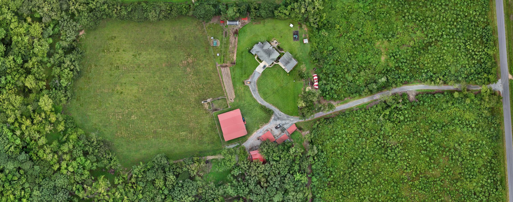
RDU Drone provides orthophotos, GeoTIFF deliverables, and mapping support for farms, landowners, venues, and site-focused projects across Raleigh-Durham. This is where visual presentation starts to overlap with practical overhead documentation.
Farms, landowners, agrotourism properties, venues, destination-style sites, and projects where a clean overhead view adds value beyond standard photography.
Mapping work can support both presentation and practical site understanding.
Helpful when the shape, layout, circulation, or overall scale of the property matters.
Overhead views help people understand how the property fits together.
A strong starting point for future construction and land documentation projects.
A quick scan section for technical buyers and for prospects who need clarity fast.
A clean top-down property or site view that is easier to read than standard perspective photos.
Useful when the project needs a more technical file beyond a simple visual export.
Map context can be paired with a custom experience, drone media, or a broader property package.
Mapping often works best when visitors can also see the related visual offerings.
For properties that benefit from both overhead context and interior exploration.
Helpful when the property also needs standard marketing coverage.
Shows the full range of your business to visitors comparing service breadth.
Deliverables can be tailored to the project, but these are the formats most clients ask about first.
A clean overhead image that gives a readable big-picture view of the property or site.
Useful for projects that need a more technical file than a standard image export.
When it makes sense, mapping can be paired with tours or media for a stronger overall presentation.
Tell me what kind of property or project you have, and I’ll help you decide whether a stitched orthophoto, GeoTIFF, or broader media package makes the most sense.